Ch
Menu
English
Arabic
Brazil
French
German
Italian
Russian
Simplified China
Traditional China
Spanish
Turkey
India
Vietnam
Japanese
Korean
关于应用
聯絡人
Ch
English
Arabic
Brazil
French
German
Italian
Russian
Simplified China
Traditional China
Spanish
Turkey
India
Vietnam
Japanese
Korean
This section is not available yet
主頁
地圖
Isle of Man
St Johns
區域
推薦地點
娛樂
公園
景點
教會
紀念建築
商業
住宿
露營
民宿
商店
健康
餐飲
咖啡館
酒館
教育
學校
運輸
金融
公園
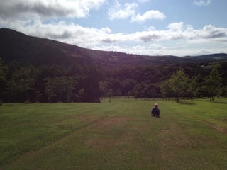
Tynwald National Park & Arboretum
German, Saint Johns, Im4 3, Isle of Man, GPS: 54.20399,-4.638849
Cooill Y Ree
Isle of Man, GPS: 54.203537,-4.643668
咖啡館
Tynwald Hill Cafe (Greens)
vegetarian $
Peel Road, Saint Johns, Isle of Man, GPS: 54.20297,-4.641981
學校
Saint Johns School
1.5
St John's School
Isle of Man, GPS: 54.201454,-4.639933
教會
St John's Methodist Church Hall
Isle of Man, GPS: 54.203022,-4.640804
The Royal Chapel Of St John The Baptist
Douglas Road, Saint Johns, Isle of Man, GPS: 54.20333,-4.6402574
民宿
Kerrowkeil Bed & Breakfast
1.5
紀念建築
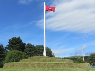
Tynwald Hill
Peel Rd (Glen Moar Rd), Saint Johns, Isle of Man, GPS: 54.203594,-4.641123
酒館
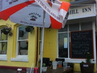
Tynwald Hill Inn
$
Main Road, Saint Johns, IM3 4NA, Isle of Man, GPS: 54.20321,-4.642344
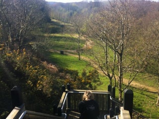
露營
Ballaspit
1.0
Show on map
Show list
MAPS.ME
總是在手
下載應用程式,開始擴大視野
開啟 MAPS.ME 應用程式
使用網頁版